3.1 Weed analysis level and classes
UseCase – The Rules for maize-weed analysis
Knowledge acquisition and representation based on the derivation of user/service requirements. Our method is based on the knowledge (historical information) about weeds etc. at the field level (cadastral map). The knowledge acquired and applied are:
● Type-of-Weed (condition/pressure level as Clustered and Non-Clustered weed).
● The size distribution of the objects (in this case Objects=’ClasterWeed’).
● Neighbourhood information (Non-ClasteredWeed).

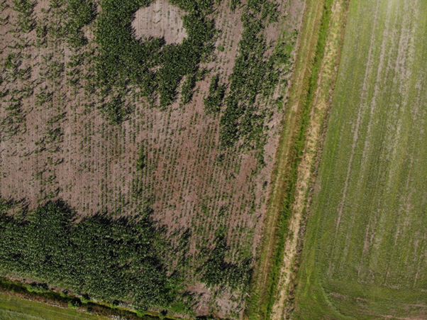
Drone RGB of Maize field in the AgriWatch research area, 2020-06-12. The image shows the pressure of different weeds (clustered and non-clustered).
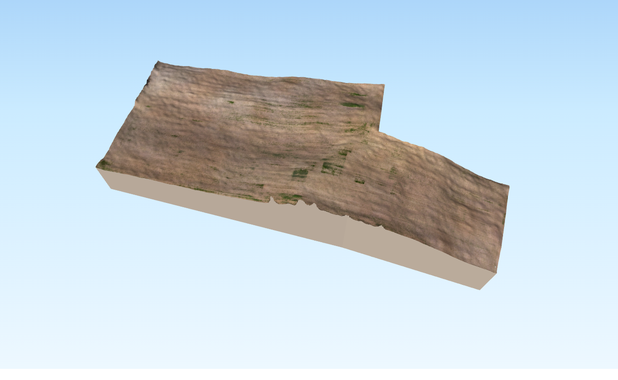
3D DEM + UAV Mosaic (RGB) of Maize field in the AgriWatch research area, 2020-06-12. The image shows the pressure of different weeds (clustered and non-clustered) on the 3D terrain.


Drone RGB of Maize fields at the AgriWatch test areas, 2020-06-12. The image shows the pressure of different weeds (clustered and non-clustered).
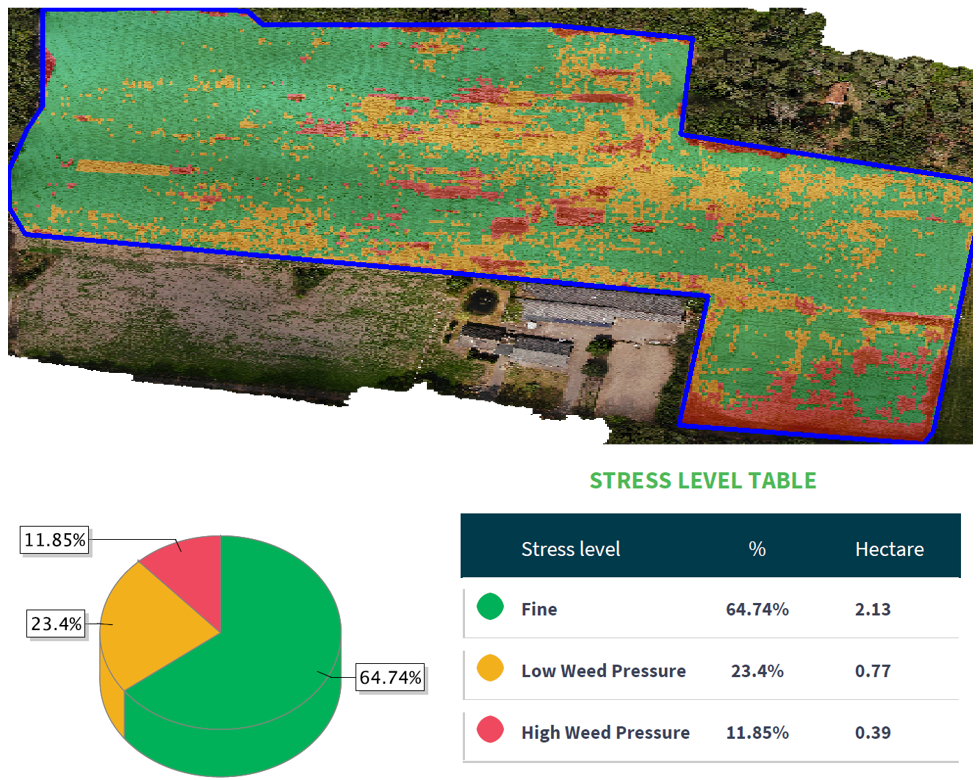
Maize-weed analysis classes for Maize#1 in the test area, Drone RGB data, 2020-06-12. Non-clustered weed (Fine and Low Weed Pressure classes) and Clustered weed (High Weed Pressure class).
Comparing the zones of weed pressure classes and affected areas in the orthomosaics. It’s important to have the right information at the right time in order to make accurate decisions. Drone data helps the farmers to get the required help on time and when in need.
Below are the mosaics of the drone images acquired on 22 July 2020 in the AgriWatch test areas for visual interpretation because of the variable sky conditions. Weeds are coming back in Maize fields (easy to detect), but much improvement in soil compared to 2019 because of the clay added in the Maize field.


Re-planted maize in Maize#2 (looks good at this stage but behind the initial planted Maize which may act as weed for the old ones!)
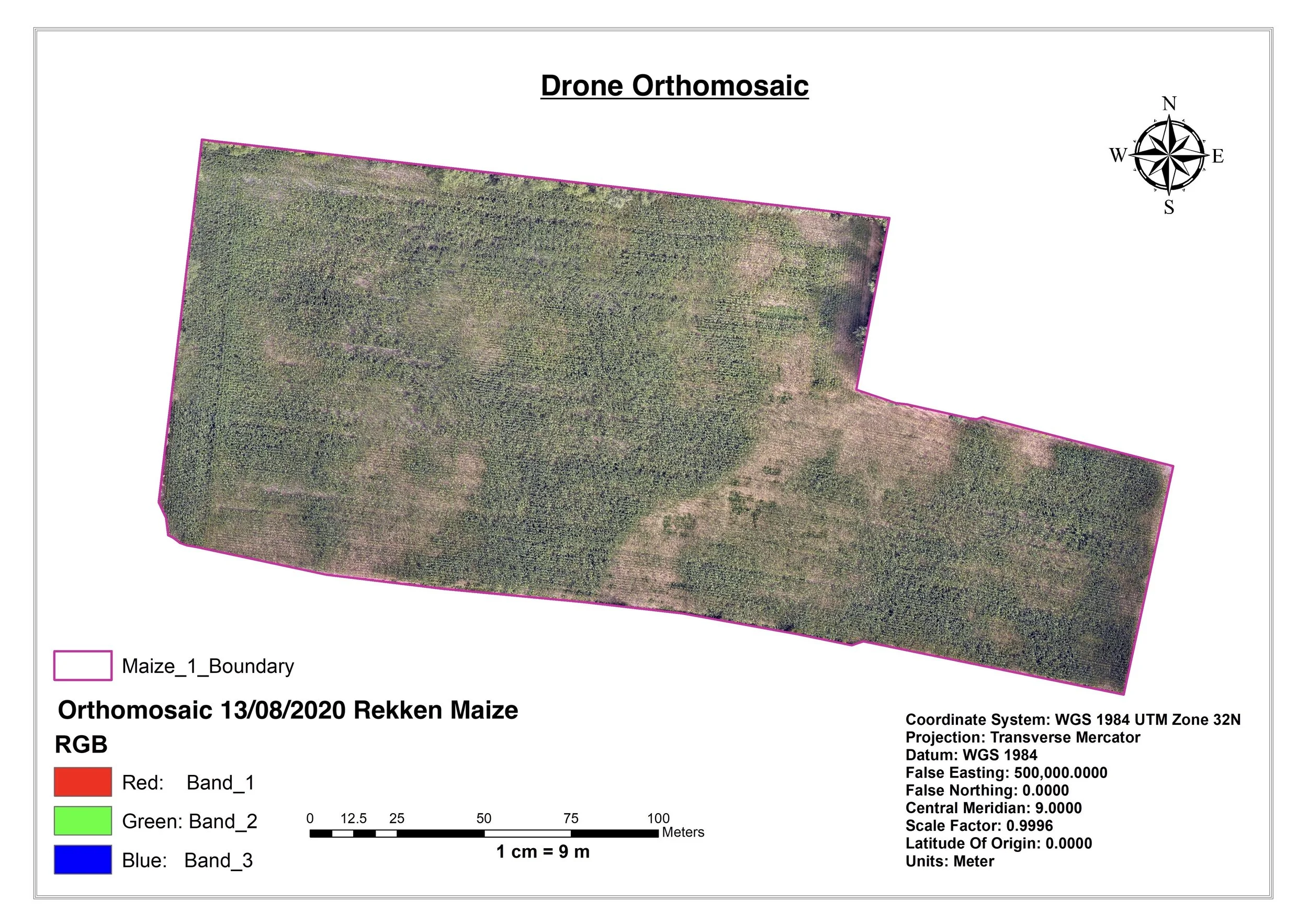
Below is the mosaic of the drone images acquired on 13 August 2020 in the research area showing the state of weed clusters .