5.12 Land subsidence using satellite data
Subsidence processes, sinkholes, or landslides can cause many problems. Even minor subsidence can weaken buildings and infrastructure and lead to issues such as flooding, and in worst cases abrupt disappearance of sections of land. Monitoring and predicting such processes are essential for adopting mitigating strategies.
The new European Ground Motion Service, created and offered by the Copernicus Land Monitoring Service and implemented by the European Environment Agency, provides free and accessible ground motion data.
Based on radar data from Copernicus Sentinel-1 satellite mission, the service provides information on the motion of land, structures and infrastructure in Copernicus Participating States. Its aim is to give users reliable information on ground motion at a local, regional or national scale.

Copernicus European Ground Motion Service; Subsidence patterns in the Netherlands (ESA, based on Copernicus Sentinel-1 data).
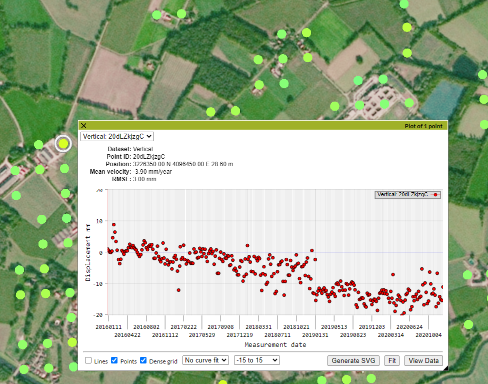
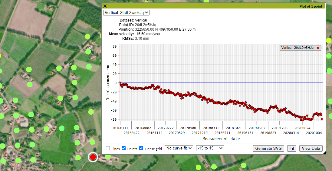
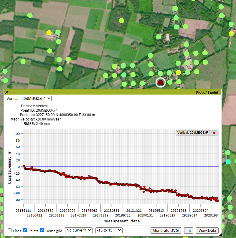
The land subsidence portal of the Copernicus program is used here to showcase the amount of land subsidence in our research study area. The land subsidence is presented in mm per year. For details, see the following gallery.